Settling of the town started in 1882. By 1900 it was quite a thriving community. In 1928 the highway came right through the main street of town. That is shown as “Front Street” on this map. In 1953 the Trans Canada highway was built 1 mile south of town. This probably helped start the decline of the community.
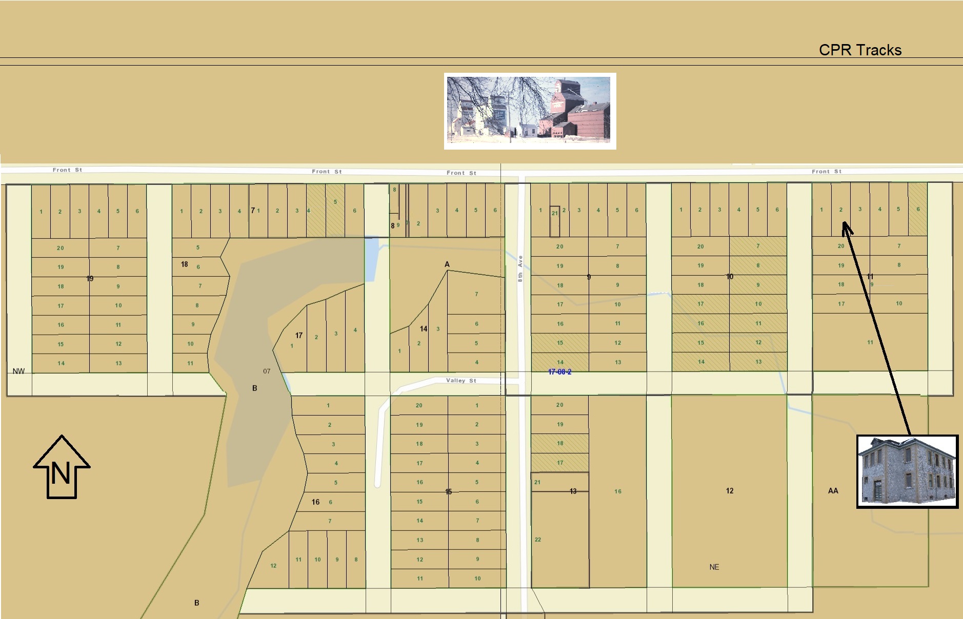
Below is a 2023 Saskatchewan Corporate Registry map of the community (blocks, lots, etc.). While most of the lots are empty now you can see it was quite a large community. The CPR tracks ran on the north side of the town, elevators were on the south side of the tracks. The railway station was on the north side of the tracks. The stone school is located on lots 1, 2 & 3 of Block 11.
Click any of the images for a larger view.
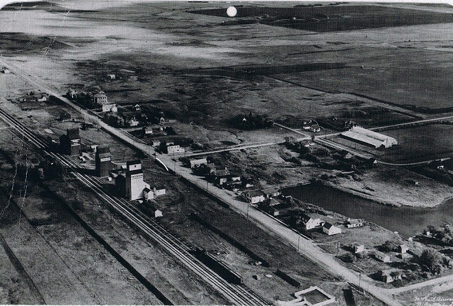
This was an aerial view of Summerberry taken for a1950 calendar. Note the 3 elevators, stone school at distance and the other notable building is the skating and curling rink on at the top right.
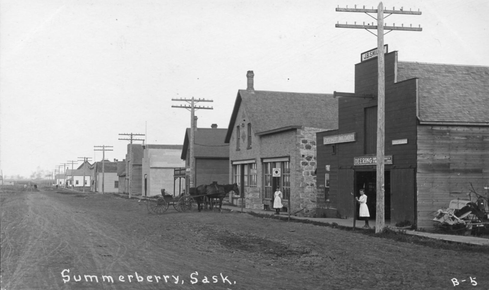
This image was on a postcard was dated 1910. This is the main street (Front Street) looking from west to east.
The first building is Massey Implements owned by JB Smiley.